
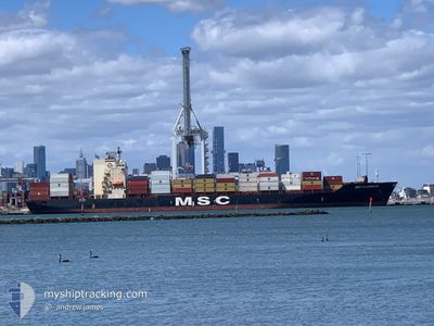
MSC ALABAMA III
Container Ship
Current Trip
NAWVB
| Time Travelled | 2 days |
|---|---|
| Remaining Time | --- |
| Distance Travelled | 78.35 nm |
| Remaining Distance | --- |
| AVG Speed | 11.3 Knopen |
| MAX Speed | 15.8 Knopen |
| AVG Wind | 7.5 knots |
| MAX Wind | 13.8 knots |
| MIN Temp | 26.5°C / 79.7°F |
| MAX Temp | 28.2°C / 82.76°F |
| Diepgang | 8.8 M |
| Positie ontvangen | 2025-11-30 11:19 |
Current Position
| Lengtegraad | -13.83385° |
|---|---|
| Breedtegraat | 9.15742° |
| Status | At anchor |
| Snelheid | |
| Koers | 208° |
| Gebied | North Atlantic Ocean |
| Station | T-AIS |
| Positie ontvangen | 2025-11-30 11:19 |
Info
Information
The current position of MSC ALABAMA III is in North Atlantic Ocean with coordinates 9.15742° / -13.83385° as reported on 2025-11-30 11:19 by AIS to our vessel tracker app. The vessel's current speed is 0 Knopen
The vessel MSC ALABAMA III (IMO: 9123166, MMSI: 371602000) is a Container Ship that was built in 1996 ( 30 Jaar oud ). It's sailing under the flag of [PA] Panama.
In this page you can find informations about the vessels current position, last detected port calls, and current voyage information. If the vessels is not in coverage by AIS you will find the latest position.
The current position of MSC ALABAMA III is detected by our AIS receivers and we are not responsible for the reliability of the data. The last position was recorded while the vessel was in Coverage by the Ais receivers of our vessel tracking app.
The current draught of MSC ALABAMA III as reported by AIS is 8.8 meters
Weather
| Temperature | 27.1°C / 80.78°F |
|---|---|
| Wind Speed | 5 knots |
| Direction | 271° W |
| Pressure | 1012.3 hPa |
| Humidity | 69.6 % |
| Cloud Coverage | 100 % |
Featured Company
Last Port Calls
| Port | Arrival | Departure | Time In Port |
|---|---|---|---|
| 2025-12-31 16:15 | 2026-01-03 10:11 | 2 d | |
| 2025-12-15 09:46 | 2025-12-16 23:06 | 1 d | |
| 2025-12-12 08:51 | 2025-12-13 11:19 | 1 d | |
| 2025-12-05 20:03 | 2025-12-07 19:07 | 1 d | |
| 2025-11-13 18:01 | 2025-11-15 11:40 | 1 d | |
| 2025-11-07 07:04 | 2025-11-12 09:00 | 5 d | |
| 2025-11-04 08:32 | 2025-11-06 15:12 | 2 d |
Last Trips
| Origin | Departure | Destination | Arrival | Distance | |
|---|---|---|---|---|---|
| 2025-12-16 23:06 | 2025-12-31 16:15 | 1129.01 nm | |||
| 2025-12-13 11:19 | 2025-12-15 09:46 | 238.92 nm | |||
| 2025-12-07 19:07 | 2025-12-12 08:51 | 1036.71 nm | |||
| 2025-11-15 11:40 | 2025-12-05 20:03 | 1175.96 nm | |||
| 2025-11-12 09:00 | 2025-11-13 18:01 | 199.12 nm | |||
| 2025-11-06 15:12 | 2025-11-07 07:04 | 154.81 nm | |||
| 2025-10-27 18:47 | 2025-11-04 08:32 | 1954.63 nm |
Events
| Tijd | Evenement | Details | Positie / Bestemming | Info |
|---|---|---|---|---|
| 2026-01-03 16:43 | Stop beweging | 14.87 nm, South of KASSA |
9.23505 / -13.80738
NAWVB
|
Snelheid: 0.3 kn Koers: 280° |
| 2026-01-03 10:11 | Start beweging | 0.58 nm, East of NASSIT |
8.49595 / -13.22658
NAWVB
|
Snelheid: 3.7 kn Koers: 303° |
| 2026-01-03 10:11 | Vertrekhaven |
|
8.49595 / -13.22658
NAWVB
|
Snelheid: 1.4 kn Koers: 274° |
| 2025-12-31 16:15 | Aankomsthaven |
|
8.49463 / -13.21724
[SL] KISSY
|
Snelheid: 1.7 kn Koers: 235° |
| 2025-12-30 06:03 | Stop beweging | 0.85 nm, North East of NASSIT |
8.50139 / -13.22453
NAWVB
|
Snelheid: 0.3 kn Koers: 91° |
| 2025-12-30 03:51 | Start beweging | 13 nm, West of NASSIT |
8.47712 / -13.45386
NAWVB
|
Snelheid: 3.8 kn Koers: 103° |