
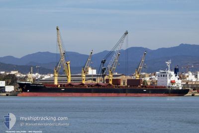
TRAWIND DOLPHIN
Bulk Carrier
Current Trip
| Time Travelled | 7 days |
|---|---|
| Remaining Time | --- |
| Distance Travelled | 2352.17 nm |
| Remaining Distance | --- |
| AVG Speed | 12.9 Knopen |
| MAX Speed | 15.7 Knopen |
| AVG Wind | 11.4 knots |
| MAX Wind | 18 knots |
| MIN Temp | 23.2°C / 73.76°F |
| MAX Temp | 29.6°C / 85.28°F |
| Diepgang | 10.3 M |
| Positie ontvangen | 4 d geleden |
Current Position
| Lengtegraad | -79.55456° |
|---|---|
| Breedtegraat | 25.65066° |
| Status | Under way using engine |
| Snelheid | 15.5 Knopen |
| Koers | 7.6° |
| Gebied | North Atlantic Ocean |
| Station | T-AIS |
| Positie ontvangen | 4 d geleden |
Information
The current position of TRAWIND DOLPHIN is in North Atlantic Ocean with coordinates 25.65066° / -79.55456° as reported on 2025-06-09 04:44 by AIS to our vessel tracker app. The vessel's current speed is 15.5 Knopen and is heading at the port of AVEIRO. The estimated time of arrival as calculated by MyShipTracking vessel tracking app is 2025-06-21 11:00 LT
The vessel TRAWIND DOLPHIN (IMO: 9562453, MMSI: 373415000) is a Bulk Carrier that was built in 2012 ( 13 Jaar oud ). It's sailing under the flag of [PA] Panama.
In this page you can find informations about the vessels current position, last detected port calls, and current voyage information. If the vessels is not in coverage by AIS you will find the latest position.
The current position of TRAWIND DOLPHIN is detected by our AIS receivers and we are not responsible for the reliability of the data. The last position was recorded while the vessel was in Coverage by the Ais receivers of our vessel tracking app.
The current draught of TRAWIND DOLPHIN as reported by AIS is 10.3 meters
Weather
| Temperature | 23.4°C / 74.12°F |
|---|---|
| Wind Speed | 16 knots |
| Direction | 249° WSW |
| Pressure | 1020.1 hPa |
| Humidity | 89.1 % |
| Cloud Coverage | 62 % |
Featured Company
Last Port Calls
| Port | Arrival | Departure | Time In Port |
|---|---|---|---|
| 2025-06-02 23:11 | 2025-06-05 23:09 | 2 d | |
| 2025-05-28 20:15 | 2025-06-01 03:35 | 3 d | |
| 2025-05-22 11:40 | 2025-05-23 13:30 | 1 d | |
| 2025-05-12 19:52 | 2025-05-15 05:19 | 2 d | |
| 2025-05-08 20:14 | 2025-05-12 08:17 | 3 d | |
| 2025-04-24 21:44 | 2025-04-28 18:24 | 3 d | |
| 2025-04-16 03:07 | 2025-04-17 20:00 | 1 d | |
| 2025-04-06 07:50 | 2025-04-12 19:44 | 6 d |
Most Visited Ports (Last year)
| Port | Arrivals | |
|---|---|---|
| 2 | ||
| 2 | ||
| 2 | ||
| 2 | ||
| 1 | ||
| 1 |
Last Trips
| Origin | Departure | Destination | Arrival | Distance | |
|---|---|---|---|---|---|
| 2025-05-31 22:35 | 2025-06-02 18:11 | 587.64 nm | |||
| 2025-05-23 08:30 | 2025-05-28 15:15 | 6.64 nm | |||
| 2025-05-15 00:19 | 2025-05-22 06:40 | 369.23 nm | |||
| 2025-05-12 03:17 | 2025-05-12 14:52 | 123.71 nm | |||
| 2025-04-28 13:24 | 2025-05-08 15:14 | 767.05 nm | |||
| 2025-04-17 16:00 | 2025-04-24 16:44 | 1269.45 nm | |||
| 2025-04-12 15:44 | 2025-04-15 23:07 | 854.72 nm | |||
| 2025-03-20 13:17 | 2025-04-06 03:50 | 4283.51 nm |
Events
| Tijd | Evenement | Details | Positie / Bestemming | Info |
|---|---|---|---|---|
| 2025-06-09 04:48 | Status Changed | Default Under way using engine |
25.66901 / -79.55202
PT AVE
|
Snelheid: 15.5 kn Koers: 7.6° |
| 2025-06-09 04:44 | Status Changed | Under way using engine Default |
25.65066 / -79.55456
PT AVE
|
Snelheid: 15.4 kn Koers: 7° |
| 2025-06-09 04:44 | Buitenbereik |
25.65066 / -79.55456
North Atlantic Ocean
PT AVE
|
Snelheid: 15.5 kn Koers: 7.6° |
|
| 2025-06-09 04:34 | Status Changed | Default Under way using engine |
25.60901 / -79.56031
PT AVE
|
Snelheid: 15.4 kn Koers: 6.9° |
| 2025-06-09 03:33 | Status Changed | Under way using engine Default |
25.34968 / -79.59531
PT AVE
|
Snelheid: 15.2 kn Koers: 7° |
| 2025-06-09 03:26 | Status Changed | Default Under way using engine |
25.31745 / -79.59931
PT AVE
|
Snelheid: 15.2 kn Koers: 6.5° |
| 2025-06-09 03:16 | Wijzig zee gebeid | Bahamas part of the North Atlantic Ocean United States part of the Gulf of Mexico |
25.27549 / -79.60476
North Atlantic Ocean
PT AVE
|
Snelheid: 15.1 kn Koers: 7° |
| 2025-06-09 03:16 | Status Changed | Under way using engine Default |
25.27549 / -79.60476
PT AVE
|
Snelheid: 15.1 kn Koers: 7° |
| 2025-06-09 02:58 | Binnenbereik |
25.27549 / -79.60476
North Atlantic Ocean
PT AVE
|
Snelheid: 15.1 kn Koers: 7° |
|
| 2025-06-06 05:29 | Buitenbereik |
28.81667 / -93.85039
Gulf of Mexico
PT AVE
|
Snelheid: 12 kn Koers: 124.5° |