
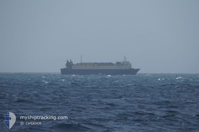
YENISEY
Vehicles Carrier
Current Trip
| Time Travelled | 20 days |
|---|---|
| Remaining Time | 1 day |
| Distance Travelled | 879.50 nm |
| Remaining Distance | 487.35 nm |
| AVG Speed | 9.5 Knopen |
| MAX Speed | 13.2 Knopen |
| AVG Wind | 18.9 knots |
| MAX Wind | 33 knots |
| MIN Temp | 0.5°C / 32.9°F |
| MAX Temp | 18.1°C / 64.58°F |
| Diepgang | 5.3 M |
| Positie ontvangen | 2025-01-07 12:05 |
Current Position
| Lengtegraad | 121.24929° |
|---|---|
| Breedtegraat | 25.30003° |
| Status | Under way using engine |
| Snelheid | 11.5 Knopen |
| Koers | 354° |
| Gebied | South China Sea |
| Station | T-AIS |
| Positie ontvangen | 2025-01-07 12:05 |
Info
Information
The current position of YENISEY is in South China Sea with coordinates 25.30003° / 121.24929° as reported on 2025-01-07 12:05 by AIS to our vessel tracker app. The vessel's current speed is 11.5 Knopen and is heading at the port of TIANJIN. The estimated time of arrival as calculated by MyShipTracking vessel tracking app is 2025-02-13 19:46 LT
The vessel YENISEY (IMO: 8911267, MMSI: 667001923) is a Vehicles Carrier that was built in 1990 ( 35 Jaar oud ). It's sailing under the flag of [SL] Sierra Leone.
In this page you can find informations about the vessels current position, last detected port calls, and current voyage information. If the vessels is not in coverage by AIS you will find the latest position.
The current position of YENISEY is detected by our AIS receivers and we are not responsible for the reliability of the data. The last position was recorded while the vessel was in Coverage by the Ais receivers of our vessel tracking app.
The current draught of YENISEY as reported by AIS is 5.3 meters
Weather
| Temperature | 1.6°C / 34.88°F |
|---|---|
| Wind Speed | 26 knots |
| Direction | 335° NNW |
| Pressure | 1023.8 hPa |
| Humidity | 54 % |
| Cloud Coverage | 38 % |
Featured Company
Last Port Calls
| Port | Arrival | Departure | Time In Port |
|---|---|---|---|
| 2025-01-23 05:16 | 2025-01-23 11:51 | 6 h | |
| 2025-01-20 02:14 | 2025-01-20 09:17 | 7 h | |
| 2025-01-18 10:46 | 2025-01-19 03:19 | 16 h | |
| 2025-01-15 02:17 | 2025-01-15 12:51 | 10 h | |
| 2025-01-07 00:40 | 2025-01-07 11:12 | 10 h | |
| 2025-01-02 18:13 | 2025-01-03 05:37 | 11 h | |
| 2024-12-17 12:32 | 2024-12-18 04:16 | 15 h | |
| 2024-12-08 21:56 | 2024-12-09 04:17 | 6 h | |
| 2024-12-03 06:04 | 2024-12-06 07:12 | 3 d | |
| 2024-12-02 02:24 | 2024-12-02 07:24 | 4 h |
Most Visited Ports (Last year)
| Port | Arrivals | |
|---|---|---|
| 28 | ||
| 26 | ||
| 6 | ||
| 5 | ||
| 4 | ||
| 3 |
Last Trips
| Origin | Departure | Destination | Arrival | Distance | |
|---|---|---|---|---|---|
| 2025-01-20 18:17 | 2025-01-23 13:16 | 799.52 nm | |||
| 2025-01-19 12:19 | 2025-01-20 11:14 | 28.75 nm | |||
| 2025-01-15 20:51 | 2025-01-18 19:46 | 451.70 nm | |||
| 2025-01-07 19:12 | 2025-01-15 10:17 | 1076.06 nm | |||
| 2025-01-03 13:37 | 2025-01-07 08:40 | 979.72 nm | |||
| 2024-12-18 12:16 | 2025-01-03 02:13 | 1471.58 nm | |||
| 2024-12-09 13:17 | 2024-12-17 20:32 | 1564.17 nm | |||
| 2024-12-06 16:12 | 2024-12-09 06:56 | 375.22 nm | |||
| 2024-12-02 16:24 | 2024-12-03 15:04 | 35.52 nm | |||
| 2024-11-23 13:24 | 2024-12-02 11:24 | 486.35 nm |
Events
| Tijd | Evenement | Details | Positie / Bestemming | Info |
|---|---|---|---|---|
| 2025-02-11 08:01 | Start beweging |
31.53966 / 122.55688
CN TXG
|
Snelheid: 4.8 kn Koers: 332° |
|
| 2025-02-08 07:58 | Stop beweging |
31.53500 / 122.56333
CN TXG
|
Snelheid: Koers: -1° |
|
| 2025-02-07 04:11 | Start beweging |
31.03829 / 122.72070
CN TXG
|
Snelheid: 4 kn Koers: 27° |