
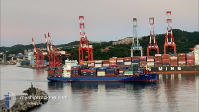
PANAY
Cargo D
Current Trip
| Time Travelled | 7 h, 41 mins |
|---|---|
| Remaining Time | 51 mins |
| Distance Travelled | 97.54 nm |
| Remaining Distance | 13.11 nm |
| AVG Speed | 13.1 Knop |
| MAX Speed | 15.3 Knop |
| AVG Wind | 4.1 knots |
| MAX Wind | 7.8 knots |
| MIN Temp | 4.6°C / 40.28°F |
| MAX Temp | 11°C / 51.8°F |
| Djupgående | 8 m |
| Position mottagen | 6 h, 44 m sen |
Current Position
| Longitud | 139.77124° |
|---|---|
| Latitude | 35.23494° |
| Status | Under way using engine |
| Fart | 13 Knop |
| Kurs | 179° |
| Område | North Pacific Ocean |
| Station | T-AIS |
| Position mottagen | 6 h, 44 m sen |
Info
Information
The current position of PANAY is in North Pacific Ocean with coordinates 35.23494° / 139.77124° as reported on 2025-02-11 19:25 by AIS to our vessel tracker app. The vessel's current speed is 13 Knop and is heading at the port of SHIMIZU. The estimated time of arrival as calculated by MyShipTracking vessel tracking app is 2025-02-12 03:01 LT
The vessel PANAY (IMO: 9937373, MMSI: 305545000) is a Cargo D It's sailing under the flag of [AG] Antigua Barbuda.
In this page you can find informations about the vessels current position, last detected port calls, and current voyage information. If the vessels is not in coverage by AIS you will find the latest position.
The current position of PANAY is detected by our AIS receivers and we are not responsible for the reliability of the data. The last position was recorded while the vessel was in Coverage by the Ais receivers of our vessel tracking app.
The current draught of PANAY as reported by AIS is 8 meters
Weather
| Temperature | 8.6°C / 47.48°F |
|---|---|
| Wind Speed | 11 knots |
| Direction | 242° WSW |
| Pressure | 1021.9 hPa |
| Humidity | 68.3 % |
| Cloud Coverage | 96 % |
Featured Company
Last Port Calls
| Port | Arrival | Departure | Time In Port |
|---|---|---|---|
| 2025-02-11 09:24 | 2025-02-11 18:29 | 9 h | |
| 2025-02-09 22:12 | 2025-02-10 20:23 | 22 h | |
| 2025-02-05 00:57 | 2025-02-05 17:05 | 16 h | |
| 2025-02-04 07:01 | 2025-02-04 13:17 | 6 h | |
| 2025-02-03 11:08 | 2025-02-03 19:09 | 8 h | |
| 2025-02-01 21:53 | 2025-02-02 09:19 | 11 h | |
| 2025-01-26 15:43 | 2025-01-28 23:29 | 2 d | |
| 2025-01-21 19:25 | 2025-01-22 04:53 | 9 h | |
| 2025-01-18 18:45 | 2025-01-19 13:05 | 18 h | |
| 2025-01-14 09:22 | 2025-01-14 16:38 | 7 h |
Last Trips
| Origin | Departure | Destination | Arrival | Distance | |
|---|---|---|---|---|---|
| 2025-02-11 05:23 | 2025-02-11 18:24 | 18.91 nm | |||
| 2025-02-06 01:05 | 2025-02-10 07:12 | 1151.75 nm | |||
| 2025-02-04 21:17 | 2025-02-05 08:57 | 113.91 nm | |||
| 2025-02-04 03:09 | 2025-02-04 15:01 | 132.08 nm | |||
| 2025-02-02 17:19 | 2025-02-03 19:08 | 354.19 nm | |||
| 2025-01-29 06:29 | 2025-02-02 05:53 | 1499.12 nm | |||
| 2025-01-22 12:53 | 2025-01-26 22:43 | 1504.57 nm | |||
| 2025-01-19 21:05 | 2025-01-22 03:25 | 161.75 nm | |||
| 2025-01-15 01:38 | 2025-01-19 02:45 | 1416.02 nm | |||
| 2025-01-14 01:56 | 2025-01-14 18:22 | 243.84 nm |
Events
| Tid | Event | Detaljer | Position / Dest | Information |
|---|---|---|---|---|
| 2025-02-11 19:33 | Status ändrad | Default Under way using engine |
35.21128 / 139.77046
JP SMZ
|
Fart: 13 kn Kurs: 179° |
| 2025-02-11 19:25 | UTANFÖR täckningsområde |
35.23494 / 139.77124
North Pacific Ocean
JP SMZ
|
Fart: 13 kn Kurs: 179° |
|
| 2025-02-11 18:29 | AVGÅTT HAMN |
|
35.41802 / 139.71294
JP SMZ
|
Fart: 12.5 kn Kurs: 195° |
| 2025-02-11 18:16 | STARTAR förflyttning |
35.44478 / 139.68493
[JP] YOKOHAMA
|
Fart: 5.2 kn Kurs: 80° |
|
| 2025-02-11 18:13 | STOPPAR förflyttning |
35.44436 / 139.68251
[JP] YOKOHAMA
|
Fart: 0.2 kn Kurs: 85° |
|
| 2025-02-11 18:06 | STARTAR förflyttning |
35.44021 / 139.68305
[JP] YOKOHAMA
|
Fart: 3.1 kn Kurs: 202° |
|
| 2025-02-11 17:51 | Status ändrad | Under way using engine Moored |
35.43784 / 139.68266
[JP] YOKOHAMA
|
Fart: Kurs: 205° |
| 2025-02-11 17:07 | Djupgående ändrat | 8 7.8 |
35.43782 / 139.68267
[JP] YOKOHAMA
|
Fart: Kurs: 205° |
| 2025-02-11 17:07 | ETA ändrat | 2025/02/12 03:00 2025/02/12 22:00 |
35.43782 / 139.68267
[JP] YOKOHAMA
|
Fart: Kurs: 205° |
| 2025-02-11 17:00 | Destination ändrad | JP SMZ JP YOK HM |
35.43784 / 139.68268
[JP] YOKOHAMA
|
Fart: Kurs: 205° |