

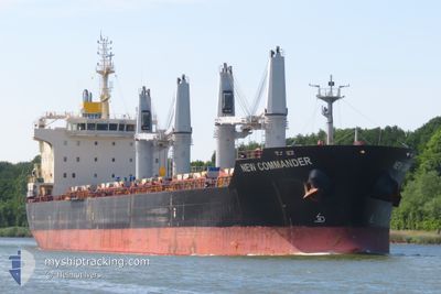
NEW COMMANDER
Bulk Carrier

Current Trip
| Time Travelled | 37 days |
|---|---|
| Remaining Time | --- |
| Distance Travelled | 8705.67 nm |
| Remaining Distance | --- |
| AVG Speed | 11.4 Knots |
| MAX Speed | 14.9 Knots |
| AVG Wind | 9.8 knots |
| MAX Wind | 29 knots |
| MIN Temp | 0.7°C / 33.26°F |
| MAX Temp | 31.3°C / 88.34°F |
| Draught | 10.8 m |
| Position Received | 10 d ago |
Current Position
| Longitude | 100.51839° |
|---|---|
| Latitude | 3.36157° |
| Status | Under way using engine |
| Speed | 13.8 Knots |
| Course | 321.9° |
| Area | Malacca Strait |
| Station | T-AIS |
| Position Received | 10 d ago |
Information
The current position of NEW COMMANDER is in Malacca Strait with coordinates 3.36157° / 100.51839° as reported on 2025-05-28 13:54 by AIS to our vessel tracker app. The vessel's current speed is 13.8 Knots
The vessel NEW COMMANDER (IMO: 9610652, MMSI: 373746000) is a Bulk Carrier that was built in 2012 ( 13 years old ). It's sailing under the flag of [PA] Panama.
In this page you can find informations about the vessels current position, last detected port calls, and current voyage information. If the vessels is not in coverage by AIS you will find the latest position.
The current position of NEW COMMANDER is detected by our AIS receivers and we are not responsible for the reliability of the data. The last position was recorded while the vessel was in Coverage by the Ais receivers of our vessel tracking app.
The current draught of NEW COMMANDER as reported by AIS is 10.8 meters
Weather
| Temperature | 27.4°C / 81.32°F |
|---|---|
| Wind Speed | 6 knots |
| Direction | 115° ESE |
| Pressure | 1005.8 hPa |
| Humidity | 86.6 % |
| Cloud Coverage | 7 % |


Featured Company
Last Port Calls
| Port | Arrival | Departure | Time In Port |
|---|---|---|---|
| 2025-04-26 17:16 | 2025-05-01 09:42 | 4 d | |
| 2025-04-01 23:25 | 2025-04-03 23:07 | 1 d |
Most Visited Ports (Last year)
| Port | Arrivals | |
|---|---|---|
| 2 | ||
| 2 | ||
| 1 | ||
| 1 | ||
| 1 | ||
| 1 |
Last Trips
| Origin | Departure | Destination | Arrival | Distance | |
|---|---|---|---|---|---|
| 2025-04-03 23:07 | 2025-04-26 17:16 | 4458.87 nm | |||
| 2025-03-25 10:44 | 2025-04-01 23:25 | 2353.25 nm |
Events
| Time | Event | Details | Position / Dest | Info |
|---|---|---|---|---|
| 2025-06-02 09:33 | STOP Moving | 3.67 nm, West of CHITTAGONG |
22.23374 / 91.75073
CHITTAGONG
|
Speed: 0.1 kn Course: 163° |
| 2025-06-02 07:06 | START Moving | 10.29 nm, South of CHITTAGONG |
22.06266 / 91.82374
CHITTAGONG
|
Speed: 4.4 kn Course: 263° |
| 2025-06-02 03:38 | STOP Moving | 10.53 nm, South of CHITTAGONG |
22.05881 / 91.82842
CHITTAGONG
|
Speed: 0.1 kn Course: 355° |