

RIVIERA
Cargo

Current Trip
| Time Travelled | 13 days |
|---|---|
| Remaining Time | --- |
| Distance Travelled | 446.69 nm |
| Remaining Distance | --- |
| AVG Speed | 7.5 Knots |
| MAX Speed | 17.8 Knots |
| AVG Wind | 4.9 knots |
| MAX Wind | 9 knots |
| MIN Temp | 5.3°C / 41.54°F |
| MAX Temp | 24.3°C / 75.74°F |
| Draught | 1.8 m |
| Position Received | 1 d ago |
Current Position
| Longitude | 14.26342° |
|---|---|
| Latitude | 48.30736° |
| Status | Under way using engine |
| Speed | 6.8 Knots |
| Course | 291.3° |
| Area | North Sea |
| Station | T-AIS |
| Position Received | 1 d ago |
Information
The current position of RIVIERA is in North Sea with coordinates 48.30736° / 14.26342° as reported on 2025-05-13 11:55 by AIS to our vessel tracker app. The vessel's current speed is 6.8 Knots and is heading at the port of KAMPEN.
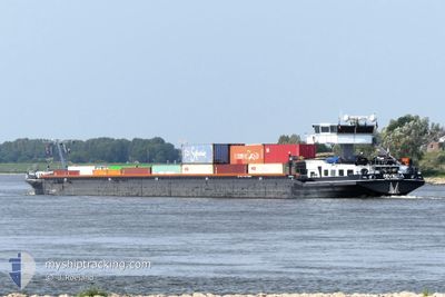
The vessel RIVIERA (MMSI: 244700375) is a Cargo It's sailing under the flag of [NL] Netherlands.
In this page you can find informations about the vessels current position, last detected port calls, and current voyage information. If the vessels is not in coverage by AIS you will find the latest position.
The current position of RIVIERA is detected by our AIS receivers and we are not responsible for the reliability of the data. The last position was recorded while the vessel was in Coverage by the Ais receivers of our vessel tracking app.
The current draught of RIVIERA as reported by AIS is 1.8 meters
Weather
| Temperature | 16.7°C / 62.06°F |
|---|---|
| Wind Speed | 6 knots |
| Direction | 124° SE |
| Pressure | 1017.3 hPa |
| Humidity | 43.3 % |
| Cloud Coverage | 1 % |


Featured Company
Last Port Calls
| Port | Arrival | Departure | Time In Port |
|---|---|---|---|
| 2025-05-01 06:26 | |||
| 2025-04-18 19:22 | 2025-04-18 19:45 | 22 m | |
| 2025-04-18 17:30 | 2025-04-18 18:14 | 44 m | |
| 2025-04-18 15:57 | 2025-04-18 16:46 | 49 m | |
| 2025-04-18 12:51 | 2025-04-18 13:26 | 35 m | |
| 2025-04-16 20:54 | 2025-04-17 06:51 | 9 h | |
| 2025-04-15 19:24 | 2025-04-15 20:31 | 1 h | |
| 2025-04-15 13:20 | 2025-04-15 14:06 | 46 m | |
| 2025-04-15 08:16 | 2025-04-15 09:15 | 59 m | |
| 2025-04-14 12:43 | 2025-04-15 07:05 | 18 h |
Last Trips
| Origin | Departure | Destination | Arrival | Distance | |
|---|---|---|---|---|---|
| 2025-04-18 18:14 | 2025-04-18 19:22 | 6.66 nm | |||
| 2025-04-18 16:46 | 2025-04-18 17:30 | 4.22 nm | |||
| 2025-04-18 13:26 | 2025-04-18 15:57 | 11.90 nm | |||
| 2025-04-17 06:51 | 2025-04-18 12:51 | 90.72 nm | |||
| 2025-04-15 20:31 | 2025-04-16 20:54 | 87.89 nm | |||
| 2025-04-15 14:06 | 2025-04-15 19:24 | 33.78 nm | |||
| 2025-04-15 09:15 | 2025-04-15 13:20 | 30.76 nm | |||
| 2025-04-15 07:05 | 2025-04-15 08:16 | 9.49 nm | |||
| 2025-04-14 10:36 | 2025-04-14 12:43 | 11.54 nm | |||
| 2025-04-12 09:45 | 2025-04-13 16:30 | 29.01 nm |
Events
| Time | Event | Details | Position / Dest | Info |
|---|---|---|---|---|
| 2025-05-13 11:55 | OUT of Coverage |
48.30736 / 14.26342
North Sea
|
Speed: 6.8 kn Course: 291.3° |
|
| 2025-05-13 10:59 | IN Coverage |
48.26886 / 14.38124
North Sea
|
Speed: 7.8 kn Course: 297.5° |
|
| 2025-05-12 05:38 | OUT of Coverage |
48.23221 / 16.39929
North Sea
|
Speed: 3.4 kn Course: 312.6° |
|
| 2025-05-12 03:57 | IN Coverage |
48.15481 / 16.52660
North Sea
|
Speed: 3.1 kn Course: 295.8° |
|
| 2025-05-11 18:21 | OUT of Coverage |
48.15135 / 16.53215
North Sea
|
Speed: 4.2 kn Course: 310.1° |
|
| 2025-05-11 18:16 | IN Coverage |
48.14630 / 16.53789
North Sea
|
Speed: 4.8 kn Course: 323.3° |
|
| 2025-05-11 15:00 | OUT of Coverage |
48.13305 / 16.88388
North Sea
|
Speed: 4.4 kn Course: 227.3° |
|
| 2025-05-11 09:36 | Destination Changed | KAMPEN GONYU |
47.89302 / 17.52711
KAMPEN
|
Speed: 8.8 kn Course: 317.2° |
| 2025-05-11 09:30 | START Moving | 13.18 nm, North West of GONYU |
47.88459 / 17.53863
GONYU
|
Speed: 6.7 kn Course: 320.5° |
| 2025-05-11 09:26 | IN Coverage |
47.88272 / 17.54108
North Sea
|
Speed: 0.5 kn Course: 307.4° |