
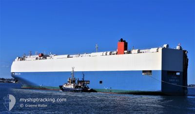
SWAN ACE
Vehicles Carrier
Current Trip
| Time Travelled | 6 h, 47 mins |
|---|---|
| Remaining Time | 9 h, 1 mins |
| Distance Travelled | 119.85 nm |
| Remaining Distance | 185.15 nm |
| AVG Speed | 18.1 Knots |
| MAX Speed | 20.5 Knots |
| AVG Wind | 19.1 knots |
| MAX Wind | 23 knots |
| MIN Temp | 11°C / 51.8°F |
| MAX Temp | 13.3°C / 55.94°F |
| Draught | 7.9 m |
| Position Received | 2 h, 0 m ago |
Current Position
| Longitude | 138.20497° |
|---|---|
| Latitude | 34.42327° |
| Status | Default |
| Speed | 19.4 Knots |
| Course | 90° |
| Area | Philippine Sea |
| Station | T-AIS |
| Position Received | 2 h, 0 m ago |
Info
Information
The current position of SWAN ACE is in Philippine Sea with coordinates 34.42327° / 138.20497° as reported on 2025-02-03 08:00 by AIS to our vessel tracker app. The vessel's current speed is 19.4 Knots and is heading at the port of HITACHINAKA. The estimated time of arrival as calculated by MyShipTracking vessel tracking app is 2025-02-03 19:01 LT
The vessel SWAN ACE (IMO: 9338826, MMSI: 309369000) is a Vehicles Carrier that was built in 2008 ( 17 years old ). It's sailing under the flag of [BS] Bahamas.
In this page you can find informations about the vessels current position, last detected port calls, and current voyage information. If the vessels is not in coverage by AIS you will find the latest position.
The current position of SWAN ACE is detected by our AIS receivers and we are not responsible for the reliability of the data. The last position was recorded while the vessel was in Coverage by the Ais receivers of our vessel tracking app.
The current draught of SWAN ACE as reported by AIS is 7.9 meters
Weather
| Temperature | 13.3°C / 55.94°F |
|---|---|
| Wind Speed | 23 knots |
| Direction | 274° W |
| Pressure | 1005.1 hPa |
| Humidity | 54.7 % |
| Cloud Coverage | 68 % |
Featured Company
Last Port Calls
| Port | Arrival | Departure | Time In Port |
|---|---|---|---|
| 2025-02-02 21:47 | 2025-02-03 03:13 | 5 h | |
| 2025-01-31 01:04 | 2025-01-31 06:46 | 5 h | |
| 2025-01-29 05:51 | 2025-01-29 13:12 | 7 h | |
| 2025-01-24 13:06 | 2025-01-24 21:37 | 8 h | |
| 2025-01-12 22:13 | 2025-01-13 14:05 | 15 h | |
| 2024-12-11 15:10 | 2024-12-13 11:03 | 1 d | |
| 2024-12-09 10:53 | 2024-12-10 01:38 | 14 h | |
| 2024-12-05 07:00 | 2024-12-05 19:08 | 12 h |
Last Trips
| Origin | Departure | Destination | Arrival | Distance | |
|---|---|---|---|---|---|
| 2025-01-31 15:46 | 2025-02-03 06:47 | 1017.54 nm | |||
| 2025-01-29 21:12 | 2025-01-31 10:04 | 479.88 nm | |||
| 2025-01-25 05:37 | 2025-01-29 13:51 | 894.94 nm | |||
| 2025-01-13 22:05 | 2025-01-24 21:06 | 2686.81 nm | |||
| 2024-12-13 12:03 | 2025-01-13 06:13 | 12574.70 nm | |||
| 2024-12-10 02:38 | 2024-12-11 16:10 | 148.58 nm | |||
| 2024-12-05 21:08 | 2024-12-09 11:53 | 1277.64 nm | |||
| 2024-11-30 20:47 | 2024-12-05 09:00 | 1528.82 nm |
Events
| Time | Event | Details | Position / Dest | Info |
|---|---|---|---|---|
| 2025-02-03 08:00 | OUT of Coverage |
34.42327 / 138.20497
Philippine Sea
JP_HIC
|
Speed: 19.4 kn Course: 90° |
|
| 2025-02-03 06:02 | Destination Changed | JP_HIC JP_MKW |
34.42895 / 137.41440
JP_HIC
|
Speed: 20.1 kn Course: 96° |
| 2025-02-03 06:02 | ETA Changed | 2025/02/03 21:15 2025/02/02 19:35 |
34.42895 / 137.41440
JP_HIC
|
Speed: 20.1 kn Course: 96° |
| 2025-02-03 05:27 | IN Coverage |
34.45122 / 137.25315
Philippine Sea
|
Speed: 19.5 kn Course: 104° |
|
| 2025-02-03 04:16 | OUT of Coverage |
34.62553 / 136.97662
Philippine Sea
|
Speed: 14.1 kn Course: 232° |
|
| 2025-02-03 03:45 | IN Coverage |
34.66978 / 137.04753
Philippine Sea
|
Speed: 16.8 kn Course: 231° |
|
| 2025-02-03 03:13 | PORT DEPARTURE |
|
34.73528 / 137.27013
JP_MKW
|
Speed: 4.9 kn Course: 273° |
| 2025-02-03 03:01 | START Moving |
34.73272 / 137.30797
[JP] TOYOHASHI
|
Speed: 4.9 kn Course: 273° |
|
| 2025-02-02 22:25 | Status Changed | Default Under way using engine |
34.73405 / 137.31326
[JP] TOYOHASHI
|
Speed: 0.1 kn Course: 282° |
| 2025-02-02 22:14 | OUT of Coverage |
34.73403 / 137.31322
Philippine Sea
[JP] TOYOHASHI
|
Speed: 0.1 kn Course: 13° |