
TOSCA
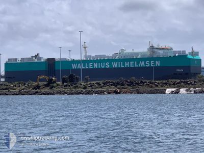
Vehicles Carrier
Current Trip
| Time Travelled | 25 days |
|---|---|
| Remaining Time | 5 days |
| Distance Travelled | 8461.08 nm |
| Remaining Distance | 1342.59 nm |
| AVG Speed | 14.6 Knots |
| MAX Speed | 19.6 Knots |
| AVG Wind | 14.4 knots |
| MAX Wind | 30 knots |
| MIN Temp | -2.8°C / 26.96°F |
| MAX Temp | 30.1°C / 86.18°F |
| Draught | 10.4 m |
| Position Received | 1 d ago |
Current Position
| Longitude | -79.63805° |
|---|---|
| Latitude | 9.78017° |
| Status | Under way using engine |
| Speed | 10.3 Knots |
| Course | 22.8° |
| Area | Caribbean Sea |
| Station | T-AIS |
| Position Received | 1 d ago |
Info
Information
The current position of TOSCA is in Caribbean Sea with coordinates 9.78017° / -79.63805° as reported on 2025-03-11 20:56 by AIS to our vessel tracker app. The vessel's current speed is 10.3 Knots and is heading at the port of BRUNSWICK. The estimated time of arrival as calculated by MyShipTracking vessel tracking app is 2025-03-18 13:16 LT
The vessel TOSCA (IMO: 9605798, MMSI: 257268000) is a Vehicles Carrier that was built in 2013 ( 12 years old ). It's sailing under the flag of [NO] Norway.
In this page you can find informations about the vessels current position, last detected port calls, and current voyage information. If the vessels is not in coverage by AIS you will find the latest position.
The current position of TOSCA is detected by our AIS receivers and we are not responsible for the reliability of the data. The last position was recorded while the vessel was in Coverage by the Ais receivers of our vessel tracking app.
The current draught of TOSCA as reported by AIS is 10.4 meters
Weather
| Temperature | 26.9°C / 80.42°F |
|---|---|
| Wind Speed | 15 knots |
| Direction | 52° NE |
| Pressure | 1011.5 hPa |
| Humidity | 74.7 % |
| Cloud Coverage | 37 % |
Featured Company
Last Port Calls
| Port | Arrival | Departure | Time In Port |
|---|---|---|---|
| 2025-02-14 15:01 | 2025-02-15 13:03 | 22 h | |
| 2025-02-09 23:53 | 2025-02-13 08:01 | 3 d | |
| 2025-01-30 22:38 | 2025-02-01 09:51 | 1 d | |
| 2025-01-16 05:51 | 2025-01-18 07:39 | 2 d | |
| 2025-01-09 06:24 | 2025-01-11 05:29 | 1 d | |
| 2025-01-02 11:01 | 2025-01-06 12:04 | 4 d |
Most Visited Ports (Last year)
| Port | Arrivals | |
|---|---|---|
| 8 | ||
| 8 | ||
| 3 | ||
| 3 | ||
| 2 | ||
| 2 |
Last Trips
| Origin | Departure | Destination | Arrival | Distance | |
|---|---|---|---|---|---|
| 2025-02-13 17:01 | 2025-02-15 00:01 | 472.88 nm | |||
| 2025-02-01 17:51 | 2025-02-10 08:53 | 2617.86 nm | |||
| 2025-01-18 18:39 | 2025-01-31 06:38 | 3975.33 nm | |||
| 2025-01-11 16:29 | 2025-01-16 16:51 | 844.15 nm | |||
| 2025-01-06 23:04 | 2025-01-09 17:24 | 217.72 nm | |||
| 2024-12-19 09:46 | 2025-01-02 22:01 | 1351.98 nm |
Events
| Time | Event | Details | Position / Dest | Info |
|---|---|---|---|---|
| 2025-03-11 20:59 | Status Changed | Default Under way using engine |
9.78907 / -79.63422
US SSI
|
Speed: 10.3 kn Course: 22.8° |
| 2025-03-11 20:56 | OUT of Coverage |
9.78017 / -79.63805
Caribbean Sea
US SSI
|
Speed: 10.3 kn Course: 22.8° |
|
| 2025-03-11 20:52 | Status Changed | Under way using engine Default |
9.77130 / -79.64302
US SSI
|
Speed: 10.7 kn Course: 46° |
| 2025-03-11 20:48 | Status Changed | Default Under way using engine |
9.76189 / -79.65073
US SSI
|
Speed: 10.7 kn Course: 47.6° |
| 2025-03-11 19:10 | Status Changed | Under way using engine Default |
9.53986 / -79.82707
US SSI
|
Speed: 11.6 kn Course: 51° |
| 2025-03-11 19:07 | Status Changed | Default Under way using engine |
9.53349 / -79.83515
US SSI
|
Speed: 11 kn Course: 50° |
| 2025-03-11 18:23 | Status Changed | Under way using engine Default |
9.42257 / -79.91794
US SSI
|
Speed: 11.4 kn Course: 1° |
| 2025-03-11 18:20 | Status Changed | Default Under way using engine |
9.41425 / -79.91775
US SSI
|
Speed: 12 kn Course: 1.5° |
| 2025-03-11 18:06 | Change Sea Area | Panamanian part of the Caribbean Sea Panamanian part of the North Pacific Ocean |
9.36839 / -79.91857
Caribbean Sea
US SSI
|
Speed: 12 kn Course: 0° |
| 2025-03-11 17:27 | START Moving | 3.9 nm, South of CRISTOBAL |
9.28217 / -79.92130
US SSI
|
Speed: 4.3 kn Course: 6° |