

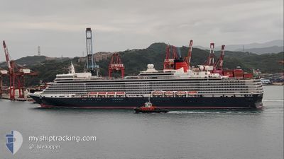
QUEEN ELIZABETH
Passengers Ship

Current Trip
| Time Travelled | 4 days |
|---|---|
| Remaining Time | 4 h, 23 mins |
| Distance Travelled | 1092.01 nm |
| Remaining Distance | 54.12 nm |
| AVG Speed | 11.8 Noeuds |
| MAX Speed | 19.2 Noeuds |
| AVG Wind | 15.4 knots |
| MAX Wind | 35 knots |
| MIN Temp | 0.6°C / 33.08°F |
| MAX Temp | 12.6°C / 54.68°F |
| Tirant d eau | 8 m |
| Position reçue | 3 m depuis |
Current Position
| Longitude | -124.40618° |
|---|---|
| Latitude | 48.37729° |
| Etat | Under way using engine |
| Vitesse | 11.5 Noeuds |
| Parcours | 115.5° |
| Zone | The Coastal Waters of Southeast Alaska and British Columbia |
| Station | T-AIS |
| Position reçue | 3 m depuis |
Information
The current position of QUEEN ELIZABETH is in The Coastal Waters of Southeast Alaska and British Columbia with coordinates 48.37729° / -124.40618° as reported on 2025-06-11 10:50 by AIS to our vessel tracker app. The vessel's current speed is 11.5 Noeuds and is heading at the port of VICTORIA. The estimated time of arrival as calculated by MyShipTracking vessel tracking app is 2025-06-11 15:17 LT
The vessel QUEEN ELIZABETH (IMO: 9477438, MMSI: 310625000) is a Passengers Ship that was built in 2010 ( 15 Age ). It's sailing under the flag of [BM] Bermuda.
In this page you can find informations about the vessels current position, last detected port calls, and current voyage information. If the vessels is not in coverage by AIS you will find the latest position.
The current position of QUEEN ELIZABETH is detected by our AIS receivers and we are not responsible for the reliability of the data. The last position was recorded while the vessel was in Coverage by the Ais receivers of our vessel tracking app.
The current draught of QUEEN ELIZABETH as reported by AIS is 8 meters
Weather
| Temperature | 9.9°C / 49.82°F |
|---|---|
| Wind Speed | 4 knots |
| Direction | 257° WSW |
| Pressure | 1013.6 hPa |
| Humidity | 94 % |
| Cloud Coverage | 7 % |


Featured Company
Last Port Calls
| Port | Arrival | Departure | Time In Port |
|---|---|---|---|
| 2025-06-06 15:49 | 2025-06-07 03:00 | 11 h | |
| 2025-06-04 15:19 | 2025-06-05 01:17 | 9 h | |
| 2025-06-03 04:44 | 2025-06-04 02:08 | 21 h | |
| 2025-05-26 20:53 | 2025-05-27 13:42 | 16 h | |
| 2025-05-25 21:21 | 2025-05-26 13:20 | 15 h | |
| 2025-05-23 20:42 | 2025-05-24 10:20 | 13 h | |
| 2025-05-22 21:49 | 2025-05-23 12:45 | 14 h | |
| 2025-05-20 23:30 | 2025-05-21 09:06 | 9 h | |
| 2025-05-19 22:02 | 2025-05-20 12:41 | 14 h | |
| 2025-05-18 22:06 | 2025-05-19 08:50 | 10 h |
Last Trips
| Origin | Departure | Destination | Arrival | Distance | |
|---|---|---|---|---|---|
| 2025-06-04 17:17 | 2025-06-06 07:49 | 643.13 nm | |||
| 2025-06-03 18:08 | 2025-06-04 07:19 | 194.88 nm | |||
| 2025-05-27 22:42 | 2025-06-02 20:44 | 2923.19 nm | |||
| 2025-05-26 22:20 | 2025-05-27 05:53 | 76.94 nm | |||
| 2025-05-24 19:20 | 2025-05-26 06:21 | 577.02 nm | |||
| 2025-05-23 21:45 | 2025-05-24 05:42 | 131.55 nm | |||
| 2025-05-21 18:06 | 2025-05-23 06:49 | 642.51 nm | |||
| 2025-05-20 21:41 | 2025-05-21 08:30 | 168.45 nm | |||
| 2025-05-19 17:50 | 2025-05-20 07:02 | 220.61 nm | |||
| 2025-05-17 22:50 | 2025-05-19 07:06 | 523.58 nm |
Events
| Heure | Evenement | Détails | Position/ Destination | Info |
|---|---|---|---|---|
| 2025-06-11 10:28 | Etat Changé | Under way using engine Default |
48.40840 / -124.50777
CA VIC
|
Vitesse: 12.2 kn Parcours: 114° |
| 2025-06-11 10:25 | Etat Changé | Default Under way using engine |
48.41255 / -124.52174
CA VIC
|
Vitesse: 12.7 kn Parcours: 114.2° |
| 2025-06-11 10:06 | Etat Changé | Under way using engine Default |
48.43806 / -124.60868
CA VIC
|
Vitesse: 11.8 kn Parcours: 112° |
| 2025-06-11 10:05 | Etat Changé | Default Under way using engine |
48.44026 / -124.61639
CA VIC
|
Vitesse: 11.7 kn Parcours: 112.2° |
| 2025-06-11 10:04 | Etat Changé | Under way using engine Default |
48.44109 / -124.61942
CA VIC
|
Vitesse: 11 kn Parcours: 116° |
| 2025-06-11 10:00 | Etat Changé | Default Under way using engine |
48.44546 / -124.63436
CA VIC
|
Vitesse: 10.8 kn Parcours: 114.7° |
| 2025-06-11 09:54 | Etat Changé | Under way using engine Default |
48.45338 / -124.65973
CA VIC
|
Vitesse: 10.9 kn Parcours: 116° |
| 2025-06-11 09:52 | Etat Changé | Default Under way using engine |
48.45604 / -124.66789
CA VIC
|
Vitesse: 11 kn Parcours: 110° |
| 2025-06-11 09:42 | Changement de zone | United States part of the The Coastal Waters of Southeast Alaska and British Columbia United States part of the North Pacific Ocean |
48.46806 / -124.71251
The Coastal Waters of Southeast Alaska and British Columbia
CA VIC
|
Vitesse: 11.1 kn Parcours: 105.2° |
| 2025-06-11 09:39 | Etat Changé | Under way using engine Default |
48.46988 / -124.72300
CA VIC
|
Vitesse: 11.9 kn Parcours: 93° |