

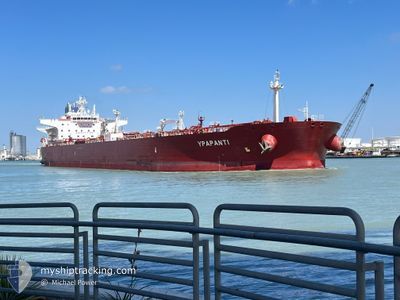
YPAPANTI
Tanker

Current Trip
| Time Travelled | 22 days |
|---|---|
| Remaining Time | --- |
| Distance Travelled | 2116.35 nm |
| Remaining Distance | --- |
| AVG Speed | 11.3 Knopen |
| MAX Speed | 11.3 Knopen |
| AVG Wind | 8.9 knots |
| MAX Wind | 22 knots |
| MIN Temp | -2.5°C / 27.5°F |
| MAX Temp | 34.2°C / 93.56°F |
| Diepgang | 12.9 M |
| Positie ontvangen | 1 d geleden |
Current Position
| Lengtegraad | 37.72100° |
|---|---|
| Breedtegraat | 24.03490° |
| Status | Under way using engine |
| Snelheid | 9.7 Knopen |
| Koers | 82.9° |
| Gebied | Red Sea |
| Station | T-AIS |
| Positie ontvangen | 1 d geleden |
Information
The current position of YPAPANTI is in Red Sea with coordinates 24.03490° / 37.72100° as reported on 2025-03-30 23:01 by AIS to our vessel tracker app. The vessel's current speed is 9.7 Knopen
The vessel YPAPANTI (IMO: 9693082, MMSI: 249279000) is a Tanker It's sailing under the flag of [MT] Malta.
In this page you can find informations about the vessels current position, last detected port calls, and current voyage information. If the vessels is not in coverage by AIS you will find the latest position.
The current position of YPAPANTI is detected by our AIS receivers and we are not responsible for the reliability of the data. The last position was recorded while the vessel was in Coverage by the Ais receivers of our vessel tracking app.
The current draught of YPAPANTI as reported by AIS is 12.9 meters
Weather
| Temperature | 25.2°C / 77.36°F |
|---|---|
| Wind Speed | 3 knots |
| Direction | 129° SE |
| Pressure | 1007.5 hPa |
| Humidity | 60.7 % |
| Cloud Coverage | 97 % |


Featured Company
Last Port Calls
| Port | Arrival | Departure | Time In Port |
|---|---|---|---|
| 2025-03-27 06:44 | 2025-03-27 15:50 | 9 h | |
| 2025-03-09 08:41 | 2025-03-09 18:05 | 9 h | |
| 2025-03-08 14:45 | 2025-03-08 19:56 | 5 h | |
| 2025-02-24 06:20 | 2025-03-01 10:20 | 5 d |
Most Visited Ports (Last year)
| Port | Arrivals | |
|---|---|---|
| 4 | ||
| 3 | ||
| 2 | ||
| 2 | ||
| 1 | ||
| 1 |
Last Trips
| Origin | Departure | Destination | Arrival | Distance | |
|---|---|---|---|---|---|
| 2025-03-09 18:05 | 2025-03-27 06:44 | 1474.77 nm | |||
| 2025-03-08 19:56 | 2025-03-09 08:41 | 121.73 nm | |||
| 2025-03-01 10:20 | 2025-03-08 14:45 | 1128.00 nm | |||
| 2025-01-22 17:39 | 2025-02-24 06:20 | 3067.91 nm |
Events
| Tijd | Evenement | Details | Positie / Bestemming | Info |
|---|---|---|---|---|
| 2025-03-31 03:25 | Stop beweging | 0.64 nm, South West of YANBU |
23.94522 / 38.20084
SA YNB
|
Snelheid: 0.3 kn Koers: 151° |
| 2025-03-30 23:08 | Status Changed | Default Under way using engine |
24.03745 / 37.74178
SA YNB
|
Snelheid: 9.7 kn Koers: 82.9° |
| 2025-03-30 23:01 | Buitenbereik |
24.03490 / 37.72100
Red Sea
|
Snelheid: 9.7 kn Koers: 82.9° |
|
| 2025-03-30 22:51 | Status Changed | Under way using engine Default |
24.03139 / 37.69176
SA YNB
|
Snelheid: 9.5 kn Koers: 84° |
| 2025-03-30 22:31 | Binnenbereik |
24.03139 / 37.69176
Red Sea
|
Snelheid: 9.5 kn Koers: 81.6° |
|
| 2025-03-30 21:27 | Start beweging |
23.99987 / 37.46518
SA YNB
|
Snelheid: 3.4 kn Koers: 82° |
|
| 2025-03-30 21:00 | Stop beweging |
23.99849 / 37.46110
SA YNB
|
Snelheid: 0.3 kn Koers: 25° |
|
| 2025-03-30 18:26 | Status Changed | Default Under way using engine |
24.02392 / 37.45699
SA YNB
|
Snelheid: 3.6 kn Koers: 282° |
| 2025-03-30 18:22 | Buitenbereik |
24.02433 / 37.46092
Red Sea
|
Snelheid: 3.6 kn Koers: 254.2° |
|
| 2025-03-30 18:10 | Status Changed | Under way using engine Default |
24.02569 / 37.47615
SA YNB
|
Snelheid: 4.9 kn Koers: 299° |